Southern California Intermountain Repeater Association
Welcome to the SCIRA Inc. Repeater Page
SCIRA, Inc.'s Linked Repeater System:
| Location | Alt (ft) | Freq (MHz) | PL (linked) | PL (unlinked) |
|---|---|---|---|---|
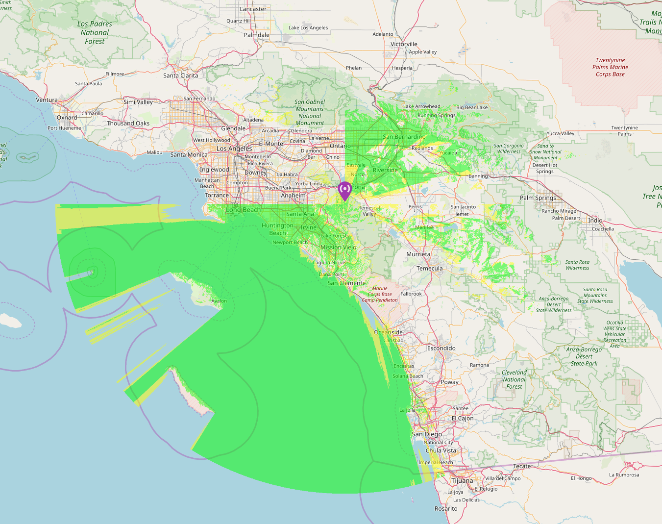
| Pleasants Peak | 3,886 | 445.940 (-) | 151.4 | 100.0 |
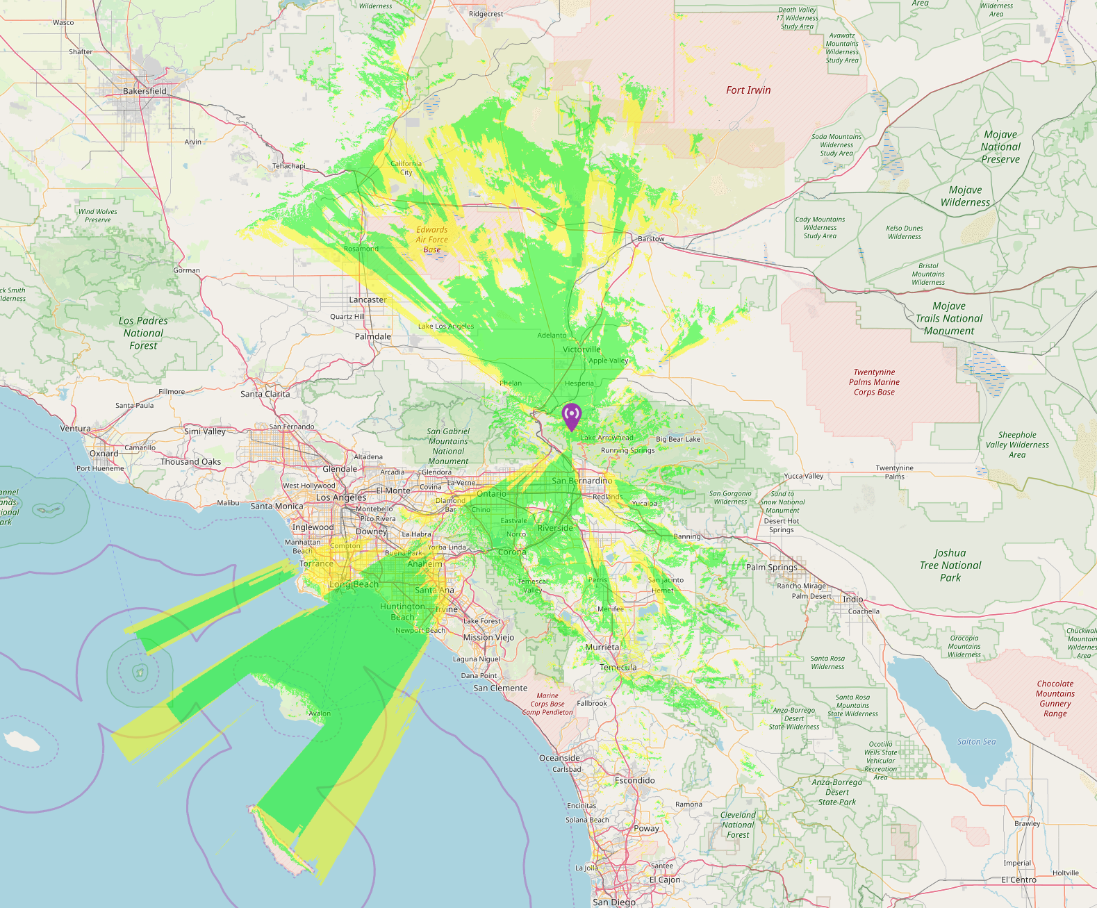
| Jobs Peak, Crestline, CA | 5,350 | 146.910 (-) | 151.4 | 67.0 |
| Ord Mountain, CA | 4,485 | 146.910 (-) | 162.2 | |
| Snow Peak, Banning, CA | 8,000 | 445.160 (-) | 67.0 | 97.4 |
| Palomar Mountain, CA | 5,582 | 445.940 (-) | 136.5 | 100.0 |
| Contractors Point, Sylmar, CA | 3,500 | 445.160 (-) | 151.4 | 100.0 |
| Eagle Tower, Running Springs, CA | 6,300 | 445.700 (-) | 151.4 | 100.0 |
| Fresno, CA | 145.250 (-) | 141.3 | ||
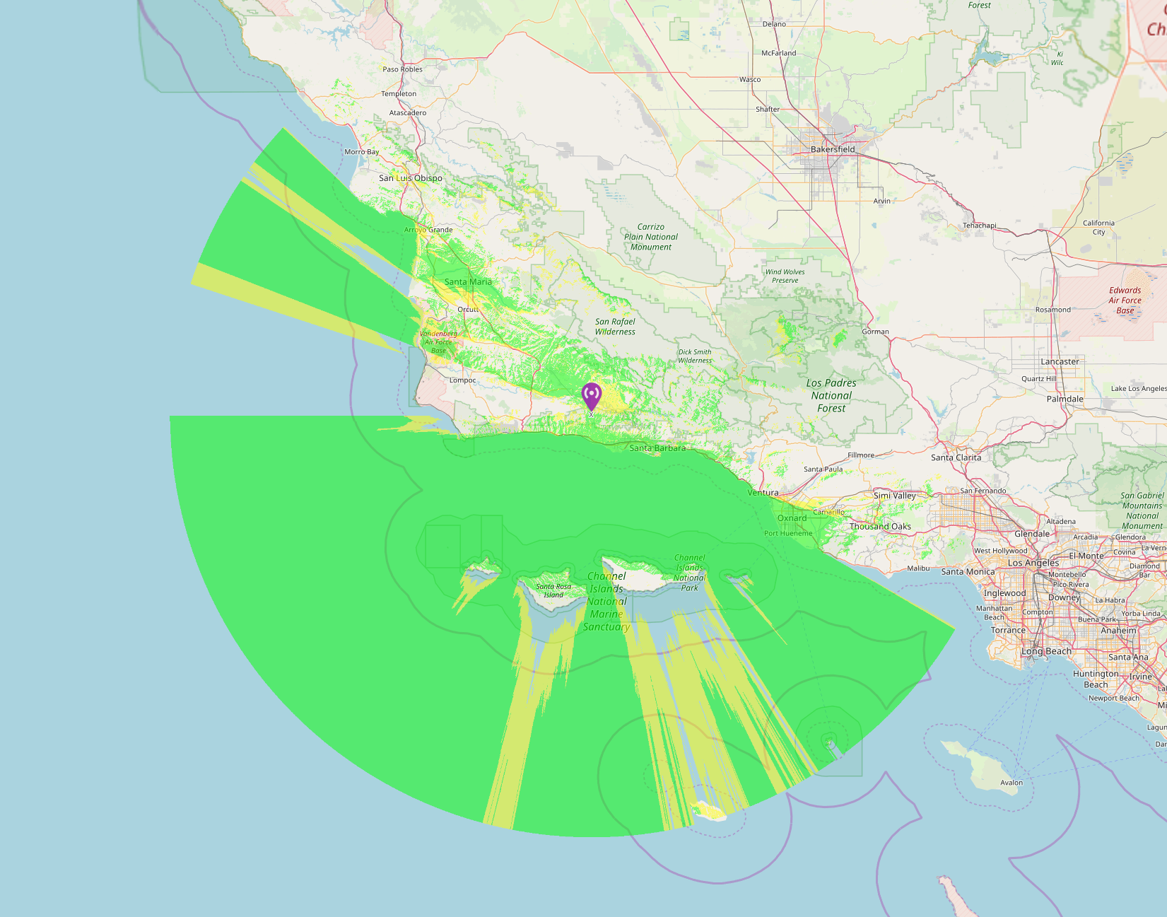
| Santa Ynez Peak, CA | 4,860 | 445.940 (-) | 131.8 | 100.0 |
Winlink Gateway Stations & Frequencies Running for SCIRA, Inc.:
AX25 packet on 144.970 MHz
VARA on 145.070 MHz
| ID/Call | Owner | Location |
|---|---|---|
| WB6TT-10 | Tom Thomas | Corona, CA |
| W6CTR-10 | SCIRA | Ontario, CA |
| KD6YPD-10 | Jared Case | Ontario, CA |
| KE6VZZ-10 | Ken Fawson | Fountain Valley, CA |
| N6NNW-10 | Dale Hanks | Rancho Palos Verdes, CA |
| KM6KHT-10 | Clint Hunter | Fontana, CA |
SCIRA, Inc. Digipeaters
All are on 144.970 MHz
| ID | Label | Location |
|---|---|---|
| ETDIGI | Eagle Tower | Running Springs, CA |
| LADIGI | L.A. | Palos Verdes area |
| FVDIGI | Fountain Valley | Fountain Valley area |
| SPDIGI | Banning | Snow Peak, CA |
Echolink Router Instructions (Link)
Echolink is running on W6CTR-R to Pleasants PL 151.4 (Node 379885)
Our Allstar node number is 48383
Repeater Coverage Map Section
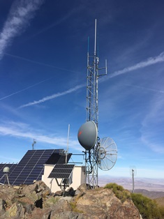
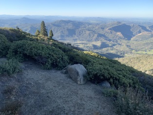
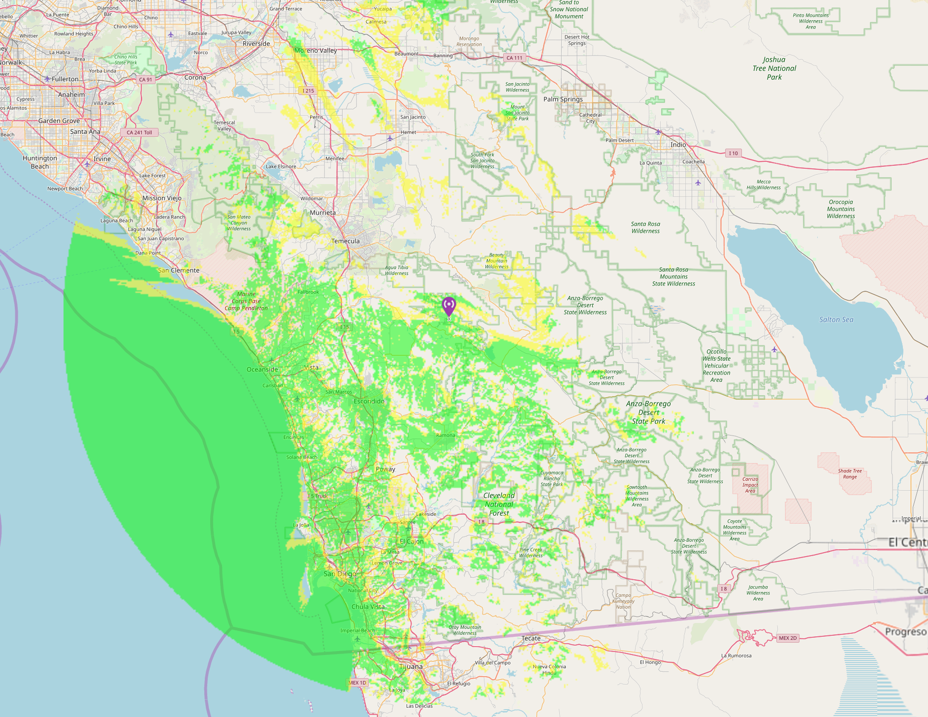
Pleasants Peak Coverage map |
33° 47' 52" North, 117° 37' 25" West |
3,886' |
No Gallery Yet |
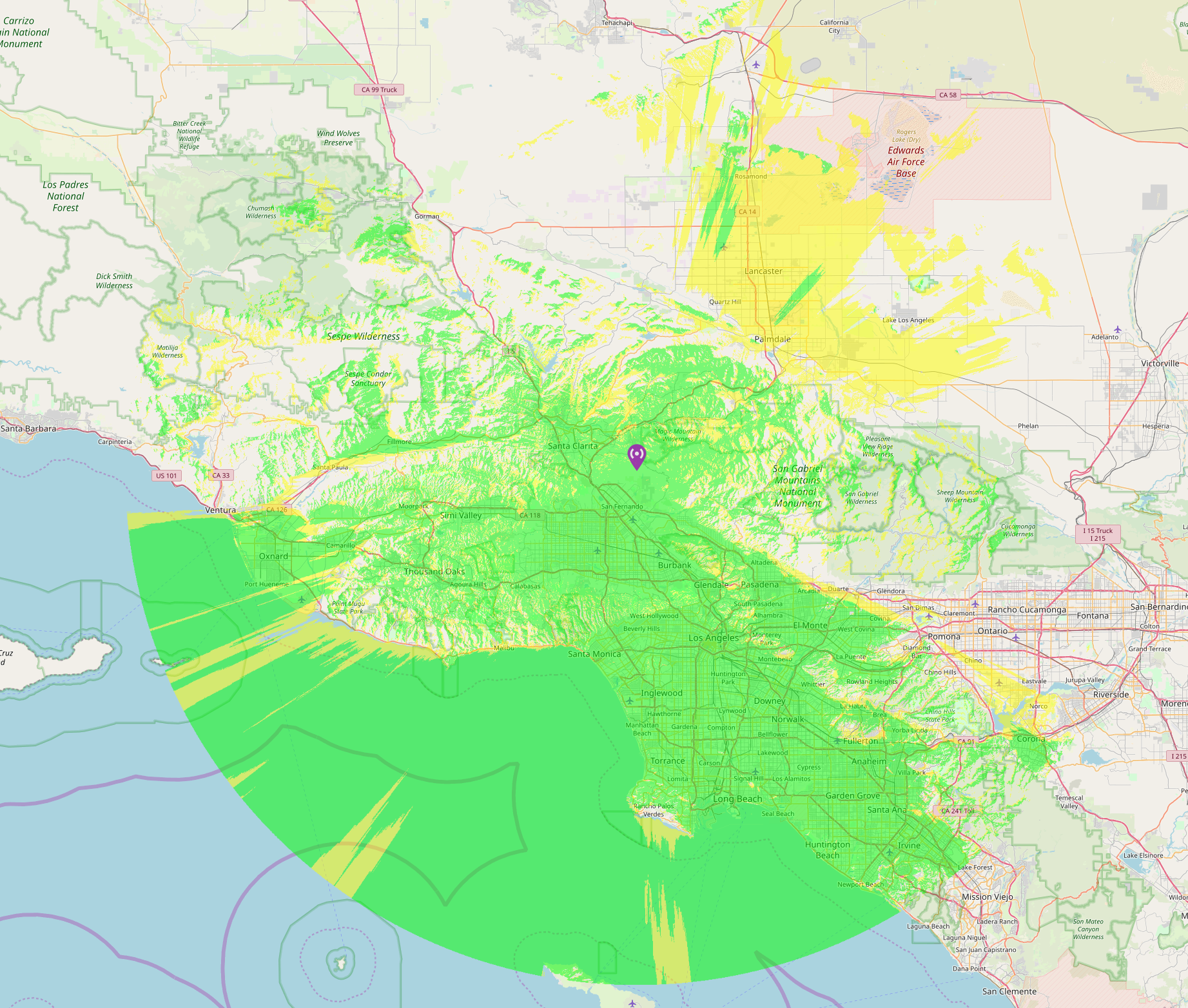
Jobs Peak, Crestline, CA Coverage map |
34° 15' 27" North, 117° 19' 46" West |
5,396' |
No Gallery Yet |
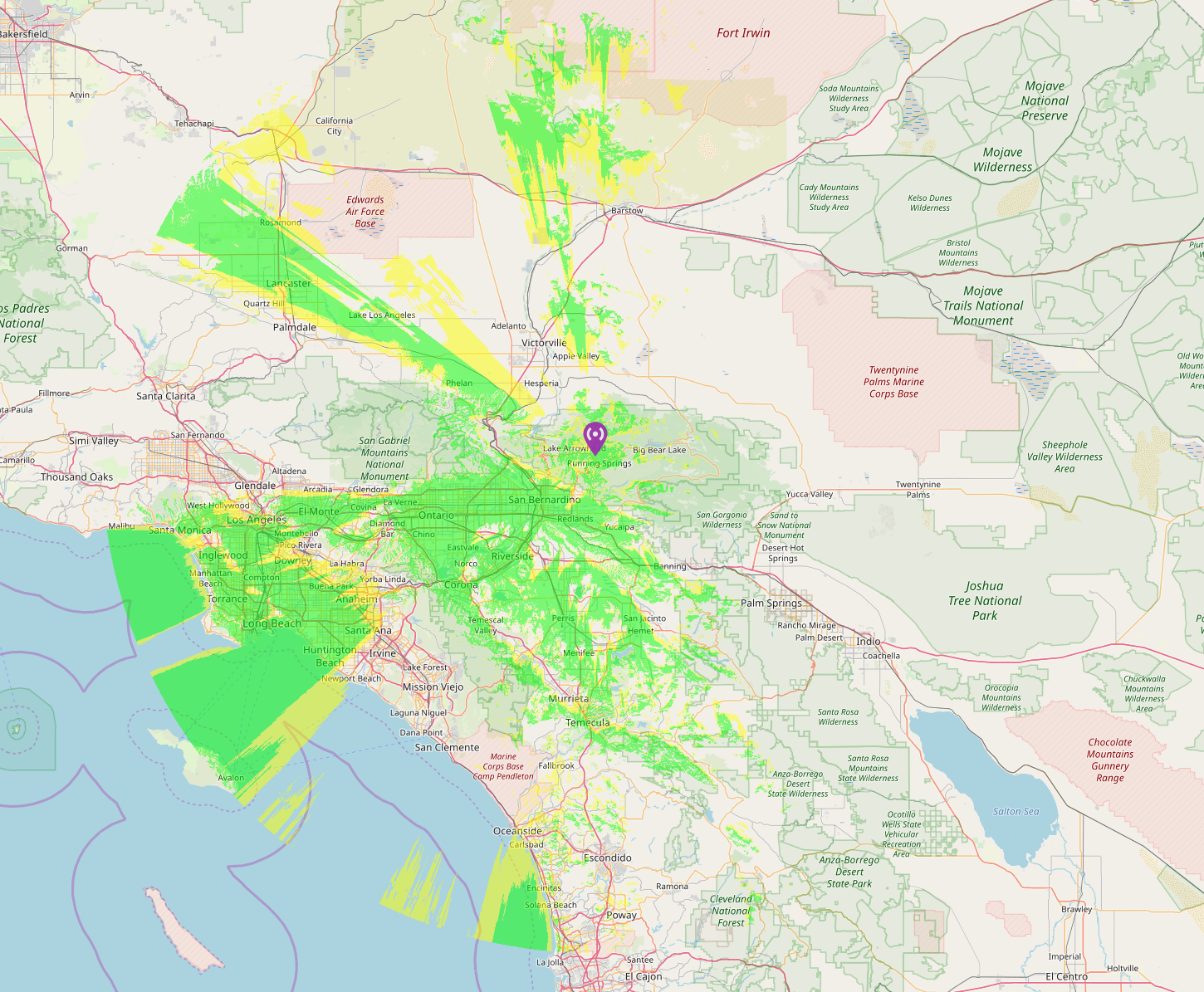
Eagle Tower, Running Springs, CA Coverage map |
34° 12' 25" North, 117° 06' 36" West |
6,123' |
No Gallery Yet |
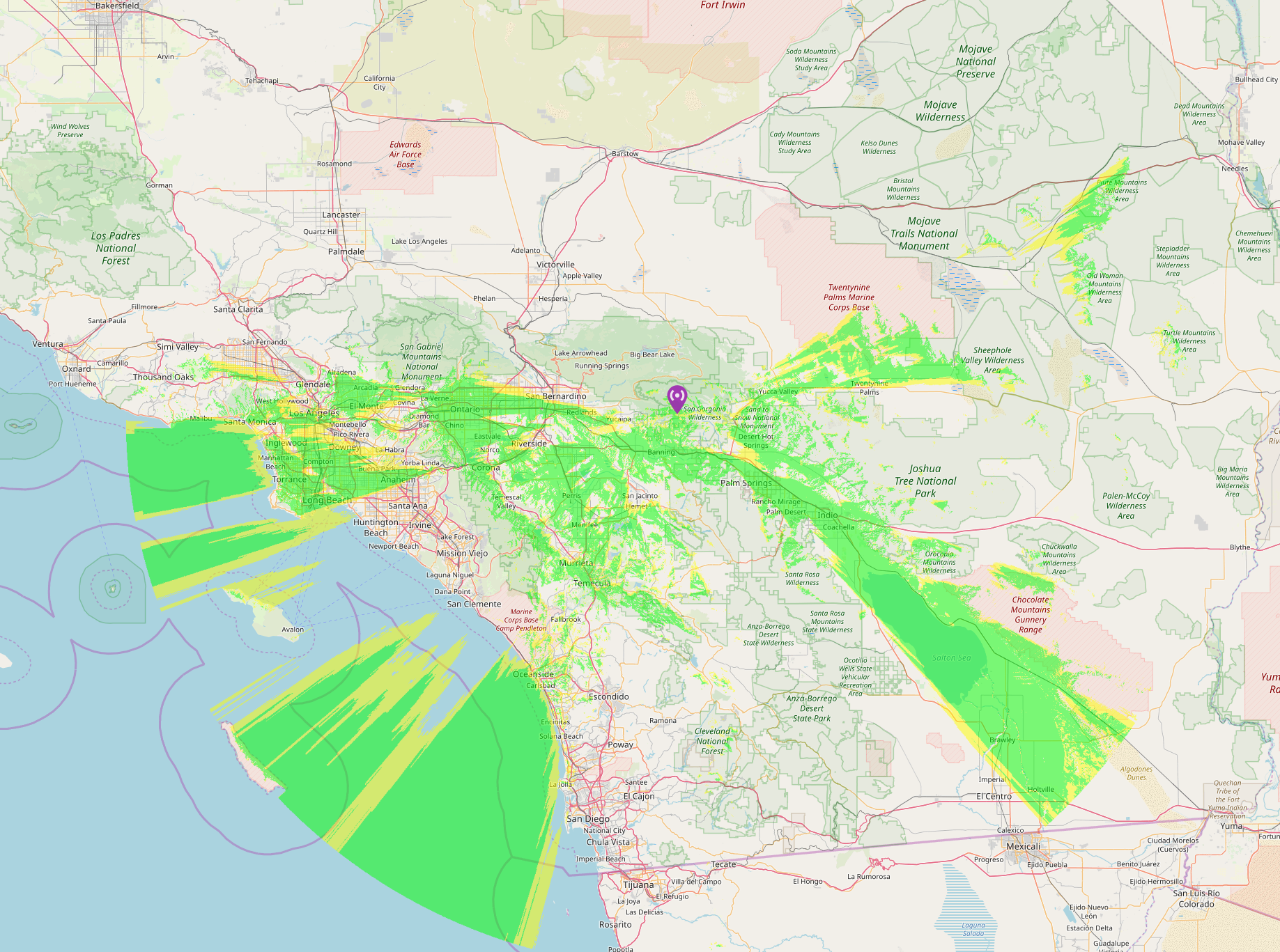
Snow Peak, Banning, CA Coverage map |
34° 02' 17" North, 116° 48' 53" West |
7,933' |
No Gallery Yet |
Contract Point, Sylmar, CA Coverage map |
34° 20' 24" North, 118° 24' 28" West |
3,500' |
No Gallery Yet |
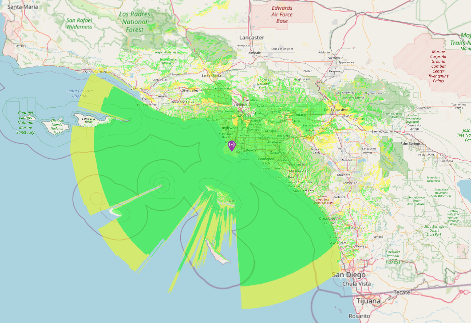
LA Digipeater, Los Angeles, CA Coverage map |
33° 44' 44.39" North, 118° 20' 14.83" West |
1449.5' |
No Gallery Yet |
Ord Mountain, CA Coverage map |
34° 39' 28" North, 116° 45' 12" West |
4,526' |
Gallery |

Palomar Mountain, CA Coverage map |
33° 18' 37" North, 116° 51' 31" West |
5,560' |
Gallery |
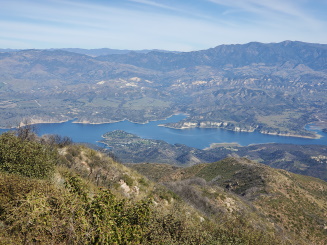
Santa Ynez Peak, CA Coverage map (under construction) |
34° 28' 47" North, 119° 25' 55" West |
4,860' |
Gallery |